Monday, October 1, 2012

Chance of severe storms later (low chance)

Most of NC is locked in a cool wedge air mass today as a weak surface high over the Great Lakes ridges down the eastern side of the Mountains and a storm systems moves in from the west/south west. 
With that comes clouds and rain 
Now watching things around southern portions of NC for later tonight as the warm front moves northward overnight, with this comes the chance for storms as more unstable airs moves in 
though the warm front may not make much progress into North Carolina tonight and may move north by early tomorrow as seen in this HPC forecast image overnight (2am) 
Though the chance is low, any storms that can develop has a good chance of rotation and with the cloud bases close enough an isolated tornado is possible (but again low chance) 


Sunday, September 16, 2012

Heavy rain event on the way for for state (NC)

Large scale rain event is taking shape across the southern half of the country. We see this on the Surface map (9:30pm EDT) 

Looking at water vapor satellite an upper low is seen over TX (outlined in red) and also in red on the top of the image is the northern stream energy that will give a kick to the southern stream over TX.
Taking a look at Monday morning we can see the northern and southern jet stream coming close to what looks like a phasing of the two jet streams. 
This should help develop a surface Low over the Gulf states-
Easterly winds here in central NC will keep transporting moisture off the Atlantic and keep things damp in some areas across the state before the heavier rains move in! 5day rainfall forecast 


Saturday, June 2, 2012

Winter like pattern for eastern US in June?

        Current temps across most of the eastern US are more like fall than early summer. The reason for this is a big upper Low over the North East US seen below on water vapor satellite.
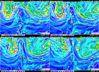
This upper Low being almost stationary for most of next week is being caused by a negative NAO or a large blocking High pressure over Greenland. This will keep most of the eastern US and North East cool with New England staying cool, cloudy and rainy at times. Here for central NC we should be temps head back to around 80 for Sunday and maybe Monday before that upper Low sends another bit of upper level energy down through parts of the Mid West and through the South East mid week seen here on the GFS model.
A frontal boundary should stall and perhaps washout somewhere over the South East next week as seen by the ECMWF model for Wednesday. 
So  while the start of June should be cool and below normal for much of the eastern US, there are some signs of the -NAO breaking down and much warmer/hot weather should flood the eastern US later in June.